Valley of Flowers Trek About Valley of Flowers The Valley of Flowers lives up to its name, with an endless supply of flowers in full bloom. The journey could even be renamed a floral fairytale romance! The Valley of Flowers' unique landscape is like a dream come true: an exquisite valley bejewelled with a never-ending stretch of flowers. Between the rocky mountain ranges of Zanskar and the Great Himalayas are lovely meadows studded with indigenous alpine flora. The area, which is a UNESCO World Heritage site, was designated as a national park in 1982. The endless stretch of gorgeous vegetation, dotted with colourful blossoms of pink, yellow, purple, red, blue, and orange hues, is the highlight of this excursion. Throughout the hike, the fragrant scent of the carpeting flowers entices you. Botanists, flower lovers, bird watchers, wildlife photographers, hikers, environment enthusiasts, and adventure seekers from all over the world are drawn to the valley's unspoiled beauty. It...
Sar Pass Trek Great Summer or Winter Trek
in Himachal Pradesh

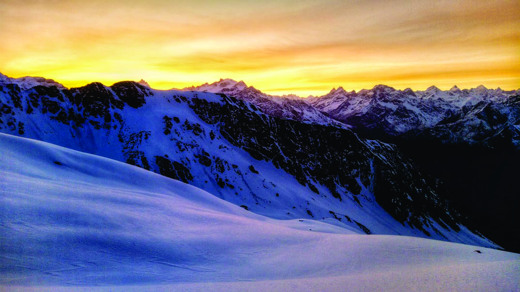
Sar Pass, located at 13,800 feet above sea level, offers the magnificence of a beautiful verdant landscape and is a photographer's, artist's, and nature lover's paradise. The Sar Pass trek, set against a curtain of majestic Himalayan peaks wrapped in snow, passes through some of the most scenic views ranging from forests to meadows to ice blankets.
While trekking from TilaLotni to Biskeri Ridge, one must pass by a small, usually frozen lake known as "Sar" in Himachal's local language. As a result, Sar Pass was born! The trail winds through the dense forest and leads to an enthralling winter wonderland.
Sar pass trek is regarded as one of the most enthralling and amazing locations in the magnificent Parvati Valley. Sar Pass trek is widely cherished and adored for its mesmerising snowy landscapes, making it a true trekking and exploration destination.
Sar pass trek is the ideal place to let all of your fantasies about snow and snow-capped mountains come true. The place has an everlasting touch of nature, which gives it an advantage over other trekking destinations. The atmosphere is calming, and it is drenched in a wave of optimism, which adds to its allure.
U CAN ALSO READ THE KEDAR TAL TREK UTTARAKHAND AN AMAZING TREK

Sar Pass Trek is one of the most popular in the Shivalik range and is filled with breathtaking natural views that will leave you dazed. This trek serves as a gateway to some of the most breathtaking Himalayan peaks.
The trail begins in the well-known Israeli village of India and winds through dense pine and rhododendron forests, lush meadows, and hamlets. The Sar Pass trek is a mountain ridge that is ideal for beginners.
Sar Pass trek provide tranquil views of the Parvati River while nestled in the Parvati Valley. The Sar Pass trek elevation is 13,780 feet, and the Sar Pass trek distance is 49 kilometres.
This trek also takes you through some of the best campsites in the area, such as Min Thach, Grahan Village, Biskari, and Nagaru.
ALSO READ RUPIN PASS TREK THE MOST BEAUTIFUL TREK TO KNOW MORE CLICK HERE
The journey starts in Kasol, also known as the backpacker's paradise. Every month, a large number of backpackers visit Kasol to rejuvenate themselves, with the majority of them being foreign visitors who immerse themselves in the bohemian lifestyle of the area.
Kasol, nestled between pine trees and snow-capped mountains, serves as the starting point for many treks in the Parvati Valley. Because of the large number of Israelis who live here and the delicious Israeli food available, Kasol is also known as India's mini-Israel.
The trek usually begins with a drive through beautiful meadows and mountains, and once the trail becomes rocky and steep, it is covered on foot.
Kheer Ganga Trek Himachal Pradesh Explore the unseen trek

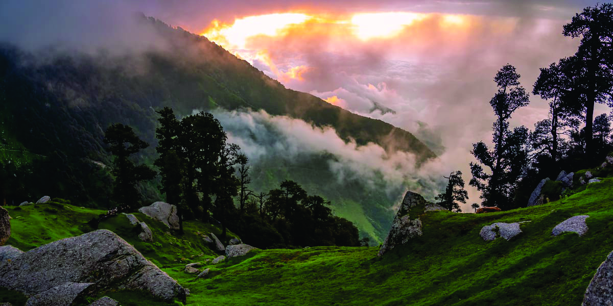
Graham village is the first campsite. GrahanNalah has an abundance of Rhododendron (red tree) growth, as well as a local bright flower known as 'buras,' which is collected in large quantities to make syrup. The journey from here is a visual delight.
The next stop is Min Thatch, which also serves as grazing stock for the livestock. The word 'thatch' means meadows,' and the journey to get here is filled with beautiful meadows and a canopy of trees. From here, make your way to the Nagaru campsite, which is slippery and has melted snow in places.
The spread of mountains across the Parvati Valley will be visible from here, and the snow and views will wash away all the tiredness. The main part of the trek begins here and leads to Sar Pass and the Biskeri Thatch. There are numerous challenges or difficulties, but what you will encounter here is out of this world.
One also gets a brief glimpse of the river crossing. The last two hours of the trek add to the list of adventures, as one comes across a 90-degree incline and the trek descent is not traversed by trekking due to its steepness, but by sliding down through the snow.
The Most Beautiful Treks of Uttarakhand to know more click here
Sar Pass Trek Overview
Sar pass is located in the Parvati Valley of Himachal Pradesh's Kullu District. Sar Pass Trek, without a doubt one of the most beautiful treks in India, promises a medley of meadows, forests, streams, and snow-covered trails.
Sar Pass is a snowy dream, with new adventures at each base camp and views that make all the shivering in the cold worthwhile. Kasol, also known as India's Mini-Israel, serves as the trek's base camp.
Sar means 'lake' in the local language. While trekking across the path, one passes by a small, usually frozen lake, hence the name Sar Pass.

Quick Facts related to Sar Pass Trek
Region: Himachal Pradesh
Trek Altitude: 13,780 ft
Trek Difficulty level: Moderate-to-Difficult
Trek Duration: 6 days
Distance: 49 km
Start point: Kasol
Endpoint: Kasol
Sar Pass Temperature: The average temperature during the day ranges between 12 degrees Celsius to 20 degrees Celsius and -2 to 6 degrees Celsius during the night
Nearest Railway station: Chandigarh
Nearest Airport: Bhuntar Airport (also known as Kullu-Manali airport)
Nearest ATM: Kasol
Sar Pass Trek Height & Altitude
Height
Sar pass trek has been blessed with a humongous and prestigious height that spans around 13,780 feet, giving trekkers and backpackers goosebumps. Height plays an important role in both trekking and tourism activities.
And Sar Pass has such a magical number that it will undoubtedly entice any trekker. When it comes to trekking in Kullu Valley, the Sar Pass Trek has always been that A-list name, and the height factor does play a much larger role in setting up this feat.
Altitude
Sar Pass trek altitude ranges between 4200m from sea level, making it a pioneer trekking site and an open invitation to trekkers and tourists to explore and trek on.
The altitude of the Sar pass trek is the most encouraging and enriching aspect of the trek, and it is one of its highlights.
SUGGESTED READ BALI PASS TREK UTTARAKHAND
Sar Pass Trek Highlights
Sar Pass trek (13850 ft) offers a beautiful trail through changing scenes of the turbulent Parvati River, gushing waterfalls, endless forests, crisp green meadows, and much more.
Visit Mini Israel of India, the Grahan Village, a 200-year-old beautiful small hidden gem in the Parvati Valley.
Walk on a carpet of sparkling fresh white snow while taking in the breathtaking views of the Parvati Valley.
Sar Pass Trek Itinerary

Day 1
Kasol to Grahan Village | Trek Through Rhododendron Forest
Duration: 4-5 hours | Elevation: 7,700 Ft. / 2,350m
Your Sar Pass trek begins in Kasol and continues to the true left of the GrahanNallah.
The trail is easy and frequently used by locals, and you can easily cover a significant distance in a couple of hours.
After passing through the GrahanNallah, the trail becomes rocky and ascends, away from the right bank of the river and through the Rhododendron forest.
The petals of the rhododendron can be eaten whole, and the syrup can be mixed with water to make a refreshing drink.
The Grahan Village is the final village of the trek, after a steep climb of about an hour, and there will be no mobile network from here on out.
BRAHMA TAL TREK IS A MAJESTIC TREK TO KNOW MORE CLICK HERE

Day 2
Grahan to Mung Thach | Follow the Trail Through Thick Cover of Trees
Duration: 4-5 hours | Elevation: 11,150 Ft. / 3,400m
Begin your climb north of the Grahan camping area towards Mung Thach via the trail commonly used by locals.
Observe the Mung Thach, Nagaru, and Sar Top on the mountain to the right after continuing your trek for a while.
Follow the steeper path that leads into the woods with a dense canopy of trees.
The path becomes more difficult in some places as the slope steepens.
After crossing the forest, arrive at your day's destination, Mung Thach.
From here, one can easily see the Chandrakhani stretch and other prominent Himalayan ranges.
BURAN GATI PASS TREK HIMACHAL PRADESH TO EXPLORE THE TREK CLICK HERE

Day 3
Mung Thach to Nagaru | Savour the first Glimpse of Snow
Duration: 5-6 hours | Elevation: 12,500 Ft. / 3,810m
In the morning, enjoy a fresh cold breeze before beginning the trek from Mung Thach to Nagaru, which will take you through the woods.
This is a difficult section of the trek because the slope drops steeply to the valley below and the snow can be slippery.
After a couple of hours of climbing a steep slope, arrive at the Nagaru campsite.
Looking north, you will see magnificent mountains across the Parvati valley, as well as the lovely town of Manikaran.
ALSO, READ ABOUT THE ROOP KUND TREK IN UTTARAKHAND
Day 4
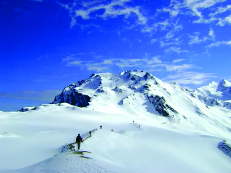
Nagaru to Biskeri Thach (6-8 hours) | Stand Tall at the Sar Pass Top at 13,800 Ft.
Duration: 6-8 hours | Elevation: 13,800 Ft. / 4,205m
Get an early start because the climb through the snow is steep; once at the top, take in the stunning views of Sar pass and the elevated peaks of the Tosh valley.
Remain at the summit for a few minutes to celebrate your accomplishment and take some amazing photos to capture the moment in time.
After that, you'll have to slide down the Biskeri, which is both exciting and completely safe as long as certain precautions are taken.
The slide can take you up to a kilometre to a gentler valley slope.
Walk for an hour through a few streams to reach the valley and, finally, the Biskeri Thach campsite.
Looking for a simple Himachal trek? Beas Kund Trek Manali to explore the details CLICK HERE
Day 5
Biskeri Thach to Kasol via Barshaini | A Trip Full of Lifetime Memories
Duration: 4-5 hours | Elevation: 10,950 Ft. / 3,340m
Hike down from Biskeri across a steep plot of land with fencing all around to reach lush grasslands.
After passing through the dense forest, cross a stream with a campsite across it.
As the twin villages of Pulga and Tulga are separated by a stream, the path to Pulga goes to the left of the campsite.
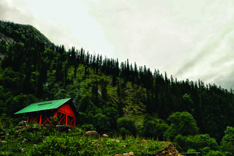
From Tulga, cross a bridge over the Parvati River to reach the village of Barshaini.
Best Time to visit Sar Pass
Summer, monsoon, and autumn are the best seasons for the Sar Pass Trek. Trekking to Sar Pass is thus best done between May and October.
Sar Pass is also a snow trek, so be cautious of the weather. May to October is the best time to trek the Sar Pass because the weather isn't too extreme and you can enjoy the thick blankets of snow at higher altitudes. The snow slides are also very enjoyable during this time, and you can see bright, colourful, and beautiful flora and fauna.
In comparison, the snowfall in May is significantly higher. In June, the snow begins to melt, leaving a fresh trail of greenery behind. The weather is ideal and suitable during these months, but once at the top, the weather changes and one must be prepared to be surprised by rainfall, hailstorms, and even snowfall.

HEAVEN ON EARTH THE BHRIGU LAKE TREK HIMACHAL PRADESH
Sar Pass trekking is not possible in the winter. Summer weather is typically unpredictable, and winters can be extremely snowy. The snow accumulates and the weather becomes dangerous for treks, so it is usually not recommended during this season.
Sar Pass trek Weather and Temperature
During the summer, the average temperature in the Sar pass trek ranges from -5 to 12 degrees Celsius.
The Sar pass temperature in May ranges between -1 and -2 degrees Celsius at the base camp and -5 to -10 degrees Celsius at Nagaru. When the season changes and the nights become even chillier, the temperature in the Sar pass trek begins to fall.
It is advisable to bring appropriate equipment, shoes, and woollen clothing. Because the temperature drops significantly during the night, it is critical to be fully prepared.
THE "Queen of Winter Treks." KEDAR KANTHA TREK UTTARAKHAND
Sar Pass Trek Difficulty.
Sar Pass is a moderately difficult trek. Sar Pass trekking is possible even if you have no prior trekking experience. At the top, there is a nearly vertical incline and a steep descent.
When you get higher, the air becomes thinner and the oxygen level drops. This trek is easy-to-moderate in comparison to other difficult treks.
Though the trek is moderate, there are some challenging sections. The path is a little risky while trekking through the vertical incline, but with the views of the majestic mountains around you, it all goes smoothly.
'Mountain of the Serpent', The Nag Tibba trek
There is a chance that heavy blankets of snow will surround you as you slide down the decline. While sliding through the snow is an entirely different experience in and of itself, one should be aware that snow accumulates inside clothes and shoes, making trekking forward with snow in and around a little chilly.
One must also be prepared to walk/slide through knee-deep snow to reach the next campsite. Occasionally, there is a chance of snowfall/rainfall in the middle of a trek, making it difficult to walk in the snow in the middle of a snowfall.
Nonetheless, the experience is surreal and magical. This is the most difficult part of the trek, and once completed, the rest of the trail is straightforward.
Is Sar Pass Trek safe?
The Sar Pass trek is risk-free for everyone. Despite the steep inclines and declines, trekking is completely safe and the risk is very low. The treks are always conducted with the presence of guides and expert supervision.
There is also constant local guidance throughout the various campsites. Because of the snow trekking, it is usually not a good idea to go alone. As one ascends, the altitude rises and the weather changes, but the atmosphere remains safe for trekking.
In any case, if there are any sudden changes in the weather, the trekkers are informed ahead of time, and whatever precautions are taken are in their best interests.
The Most Beautiful Treks of Uttarakhand to know more click here
Sar Pass Trek Location & Sar Pass Trek Distance
The super luxurious Sar pass trek has a moderate distance of around 48km, making it quite long. Though it may appear to be a large trek, it is not; the trek is full of unparalleled exploration and breathtaking scenery.
The entire distance of the Sar Pass trek is truly justifying one to its stipulated distance. The trek has many super amazing and super wonderful sightings, making it unquestionably an ideal one for tourism and trekking purposes.
Sar Pass Trek for Beginners
Sar Pass Trek has been classified as Easy to Moderately Difficult, and it is known for testing the sheer endurance levels. The Sar pass trek instils joy and excitement in both trekkers and tourists.
When it comes to beginners, this trek does signal a challenge and a preconceived notion of trekking skills. It's ideal for beginners to hone their trekking skills, but they must be cautious and mindful of the trek's moderate difficulty.
More Details about Sar Pass Trek
Know Before You Go for Sar Pass Trek
Climatic conditions in high altitudes differ from those in the plains; allow enough time to acclimate to high altitudes.
The trek passes through an environmentally friendly zone; do not encourage littering at local sites or campsites. Littering by travellers may result in a fine.
Because water is so valuable, conservation is encouraged.
Avoid using plastic bags to preserve the destinations' ecological balance.
Bring dry snacks/food from home (you will save a lot of money). Carry water bottles with you so you can refill them.
Avoid wearing earphones on the hike; they may impair your audibility.
It is advised to bring enough warm clothing and appropriate footwear for the Sar Pass Trek.
Things To Carry for Sar Pass Trek
Head torch
Rain cover
Warm clothes
Caps
Backpack (50-60l)
Day pack (20-30l)
Water bottle
Extra pair of socks
Fleece jackets and thermals
Hiking shoes
In Short, this is trek is one of the best trek to enjoy different shades of nature and different types of climate in 6 to 7 days. The mesmerizing breathtaking views of the greater Himalayas gives the best experience for a lifetime.
Comments
Post a Comment
If you have any doubt please let me know